Why we carried out this investigation
The Ord East Kimberley Expansion Project Group was responsible for making land and water data accessible to potential developers, and asked the Department to provide information on the condition of the Mantinea Development area as part of the land release process.
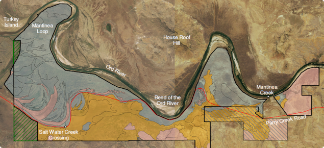
The Mantinea Development area is located on the south bank of the Ord River, 30 kilometres north-west of Kununurra. It covers about 9500 hectares (ha), 430 ha of which has been set aside in the Mantinea conservation excision. The development area consists mainly of alluvial sands and loams. The Mantinea Flat – Carlton Plain area was identified as potentially suitable for irrigated agriculture by the Department of Agriculture and CSIRO as early as 1944, from soil surveys of about 12 000ha in the area.
What we found
We reviewed relevant soil and water data from a range of historic sources and assessed the collated information. The collated soils information indicated that 73% of the area (6600ha) was covered in sands and loams. Based on the information in this review, we found that 4796 ha (53%) of the proposed development area potentially had high capability for irrigated agriculture and 2876 ha (32%) had reasonable capability but requires more investigation.
An airborne electromagnetics survey indicated that subsoil conductivities – an indicator of salinity – were highly variable across the development area, including portions of the area assessed as having high capability for irrigated agriculture. Analysis of the bore data showed groundwater levels within 4–7 m of the surface were marginally to highly saline and had remained relatively stable in the period 1996–2013. Careful management of groundwater in the development area would be required to prevent waterlogging and salinity.
For more information
Download a copy of Resource management technical report 389, Preliminary soil and groundwater assessment of the Mantinea Development area, East Kimberley, Western Australia (PDF 4.2MB).

