The further $5 million was later provided to upgrade the Coastal radars. This $5 million State Government investment was utilised to upgrade the Albany (about $2.3 million) and Geraldton radars (about $2.3 million) to Doppler capacity.
The Bureau of Meteorology (BoM) provided separate funding for the upgrading of the Esperance radar to Doppler capability.
Upgrading of these three coastal sites was completed in February 2020.
Managed by the Department of Primary Industries and Regional Development (DPIRD) and supported by the Bureau of Meteorology (BoM), now that the upgrades have been completed this investment will provide nearly full radar coverage across the entire grainbelt with more precise weather information, which will be easily accessible for farm businesses and rural communities throughout the regions.
Background
Technology is more important than ever in ensuring our state’s agricultural sector remains internationally competitive, because of both widespread technology adoption in overseas competitor markets and cheap labour availability in certain overseas locations.
In addition to technology, weather is seen as the most important factor contributing to the success of our agricultural farm businesses. With greater seasonal variability the importance of weather to agricultural production is increasing.
Doppler radar locations
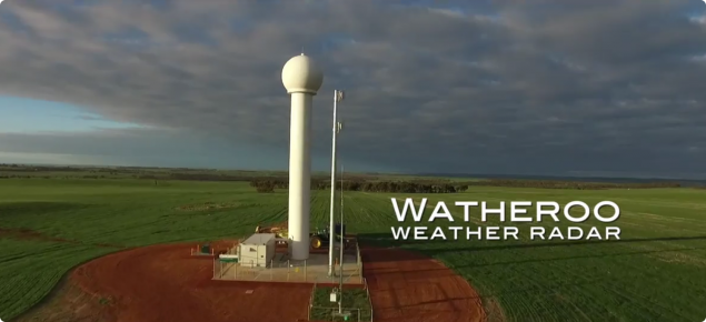
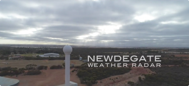
Doppler radars have now been built and are online in the Wheatbelt at Newdegate, South Doodlakine and Watheroo, with each providing a maximum range of 200 kilometres.
Installation of the radars was completed in 2017. The Bureau of Meteorology is responsible for the installation and maintenance of the radars at the three sites in WA's agricultural region.

DPIRD is committed to acknowledging the traditional custodians of the land and with guidance from the South West Aboriginal Land and Sea Council, the radars have been given names to reflect Noongar traditions and their function.
- Newdegate - Malkar Waadiny (looking for thunder cloud)
- South Doodlakine - Maar Waadiny (looking for cloud)
- Watheroo - Maar Warbiny Waadiny (looking for billowing cloud)

Benefits of Doppler radars
Strategic investment into Doppler radar infrastructure enables more informed decisions ensuring farm inputs are applied more efficiently and effectively.
Doppler radars offer short-term weather forecasting and accurate climatic information at a localised level that enable farm businesses to make more informed decisions. This means farm businesses can make timely, strategic and tactical decisions around time of sowing, chemical and fertiliser applications and movement of stock, potentially resulting in significant savings.
A study in the Orana region of New South Wales found the cost of spraying at the wrong time, such as just before rainfall, on a single property could range from $50,000-$100,000.
DPIRD’s extended network of automated weather stations, with data streamed on the DPIRD Weather Website, will be a critical part of the successful deployment of the Doppler technology. Information from modern Doppler radars, when combined with data provided by the state’s weather station network, will provide farm businesses with extremely valuable and more precise farm level information on areas such as rainfall, wind strength, temperature and soil moisture.
In a broader community setting this technology will result in improved protection of lives and livelihoods in regional Western Australia particularly when confronted with fires, storms and floods.
This technology enables insurance products to be developed to better farm business incomes and boost opportunities for additional capital investment in the industry.

How Radar works
What is RADAR?
RADAR stands for RAdio Detecting And Ranging and is based on the use of microwaves that are sent out from a transmitter in a series of pulses.
How it works
The transmitter creates a pulse, sent out by a curved antenna, which focuses the waves into a precise and narrow beam. The antenna rotates as it sends out the pulses, enabling the radar to 'see' over a large area. As the pulses move out from the transmitter they intercept objects in the atmosphere – such as rain drops, hail or snow – these reflect energy back to the RADAR. To detect these particles, the antenna rotates once every 30 seconds to make measurements at 14 different elevations. These multiple angle scans are then combined into a Constant Altitude Plan Position Indicator, or CAPPI, image. The amount of reflected energy received by the RADAR depends on the size and shape of the particles, the number of particles and whether they are liquid (water) or solid (ice).
Radar images
The received data is detected, then amplified and turned into a video signal by a receiver. The receiver assigns an approximate rain rate for each signal it receives and that rain rate has a colour assigned to it. The completed image is then sent to the web. These images are updated every six or 10 minutes, depending on the type of radar.
Doppler radar
Doppler radars differ from other radars, as they not only detect the presence of rain drops and other precipitation particles, they also detect the motion of those particles either towards or away from the radar.
They measure the speed at which the particles are moving, providing valuable information to forecasters and others about the severity of thunderstorms, the timing of wind changes and other phenomena which can’t be detected by normal radars.
More information is available on BoM's website.


